
Port Moody launches updated mapping system
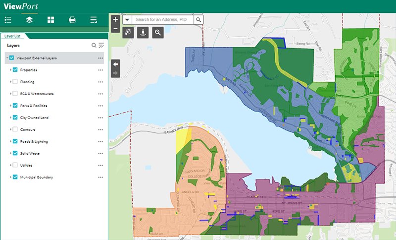
ViewPort, the City’s web-based mapping system (also known as a geographic information system or GIS), is now easier to use whether you’re at home, at work, or on the go!
Newly updated, ViewPort now:
- has an intuitive and easy-to-use interface with quick rendering – it’s now simpler and faster to find what you’re looking for;
- supports a variety of mobile devices – access it on your tablet or smartphone;
- includes a “draw” feature so you can mark up the map with your notes and print as a PDF file;
- gives you the option to view, in a table, the detailed information contained in the map layers (e.g. watermains, watercourses, zoning designations, heritage properties/areas, solid waste collection zones); and
- gives you the option to download datasets from the City’s Open Data Portal for exporting to various formats (e.g. shapefile, Keyhole Markup Language, spreadsheets).
Visit portmoody.ca/viewport to check out the new features of our updated mapping system. Take a look at our Quick Reference Guide to learn more about how to use ViewPort or read through our frequently asked questions. If you have additional questions or feedback, please email us at viewport@portmoody.ca or fill out our web form.
Subscribe
Back to News Search
Contact Us
City Hall
100 Newport Drive
Port Moody, B.C.
V3H 5C3
604.469.4500
Email